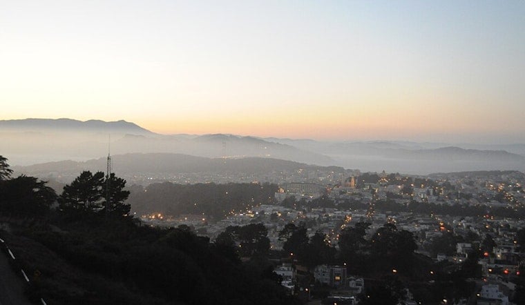
Today at 4:43 AM, readings near San Francisco International Airport showed a cool 55°F under a stubborn marine layer with very humid air sitting over the Bay. In other words, it is a classic summer setup: cool, gray mornings hugging the waterfront, then sunnier, breezier afternoons with daytime highs in San Francisco around 69°F.
Foggy Mornings, Sunny Afternoons
The marine layer is expected to hang on each morning, keeping neighborhoods right on the coast in the low to mid 60s while inland parts of the Bay warm up more by midday. Today’s high is forecast near 69°F, and tonight’s low should slip to about 54°F, with tomorrow looking very similar before a more noticeable inland warm-up arrives midweek. Closer to the water, expect clouds to stick around longer, while communities farther inland should see more afternoon sun.
Afternoon Winds And Small Craft Advisory
Southwest winds this afternoon should blow around 5 to 12 mph, with onshore breezes of 6 to 13 mph and gusts up to roughly 18 mph possible during the holiday tomorrow. A Small Craft Advisory remains in effect for the Pt. Arena to Pt. Reyes (10 to 60 NM) zone through 9 AM tomorrow, so mariners and small craft operators should plan accordingly. For full details and updates, see the National Weather Service.
What To Expect For July 4 Views
The city plans to launch an official fireworks display from the Golden Gate Bridge tomorrow, and the weather could play a role in how much you actually see. Early evening fog may trim visibility for some waterfront viewing spots while onshore gusts steer the smoke. Expect large crowds and limited road access, so consider using public transit and the city’s special event routing as outlined by the SFMTA. If you are heading out to watch, arrive early, pick a somewhat sheltered spot a bit inland from the waterfront if you are chasing clearer skies, and bring warm layers for after the show.
Weekend Outlook
The immediate coast will stay seasonably cool through the holiday weekend, while interior valleys warm more noticeably. Many Bay-adjacent areas are expected to top out in the upper 60s to low 70s, with some inland pockets reaching the mid 80s by tomorrow and into next week. Forecasters are calling for a stronger warming trend by midweek, with a chance of isolated inland readings in the upper 80s to low 90s later in the week. Check the National Weather Service before heading out for longer inland plans or outdoor events away from the water.
Quick Tips
Layer up for those foggy mornings and keep a wind-resistant jacket handy for headlands, bridges and waterfront spots, and pack water if you will be inland for long stretches. Mariners and holiday travelers should check marine and transit updates this morning and allow extra time for crowded streets and post-fireworks congestion.


.jpg)