

























































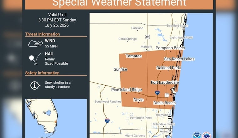
Stormy skies are muscling into Broward County this afternoon as the National Weather Service issues a special weather statement for communities including Fort Lauderdale, Pompano Beach and Davie. The advisory, in effect until 3:30 p.m. EDT on Sunday, flags reports of penny-sized hail and radar-indicated wind gusts that could reach roughly 50 to 55 mph. Forecasters are urging residents to head indoors to sturdy structures and tie down or bring in loose outdoor items as fast-moving storm cells roll through.
A special weather statement has been issued for Fort Lauderdale FL, Pompano Beach FL and Davie FL until 3:30 PM EDT
— NWS Miami (@NWSMiami) July 26, 2026
What forecasters are tracking
According to NWS Miami, the statement specifically includes Parkland, Coral Springs, Margate, Pompano Beach and Fort Lauderdale. Radar-indicated storm cores in these areas could fire off penny-sized hail and push wind gusts near 55 mph, which is strong enough to snap small branches and turn unsecured patio furniture into low-flying debris.
Safety precautions and local effects
Officials advise anyone in the path of these cells to shelter inside a sturdy building until storms move on and to avoid driving through flooded roadways, per the National Weather Service Miami forecast page. Brief but intense downpours inside these storms can trigger localized street flooding and sudden drops in visibility, turning quick errands into risky drives. Boaters are being warned to brace for fast-forming squalls and choppy seas that can catch smaller craft off guard.
When the alert ends
The special weather statement is scheduled to remain in place until 3:30 p.m. EDT and could be updated or extended if storm cores intensify, according to NWS forecasters. Residents are encouraged to keep an eye on local updates and report any hail or wind damage to help meteorologists fine-tune their warnings as the afternoon unfolds.





