

























































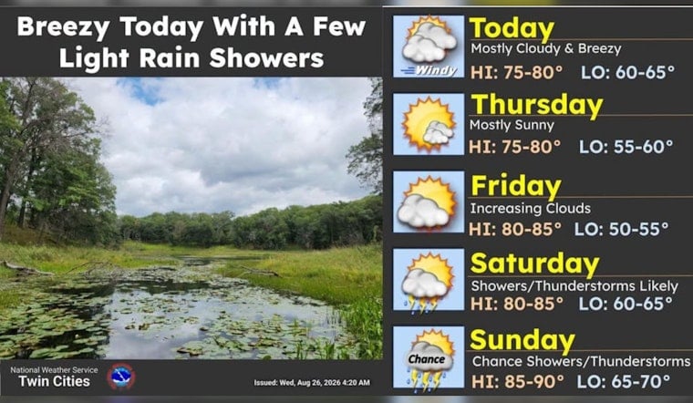
Minneapolis is waking up to mostly clear skies Wednesday, but the calm start will give way to a breezier afternoon and a high near 82 degrees. The bigger weather plot arrives this weekend, when warmer temperatures and scattered thunderstorms return to the forecast.
Afternoon Winds Pick Up
Wednesday should stay mostly sunny to partly sunny, with northwest winds increasing to around 15 mph and occasional gusts reaching 20 to 25 mph. A few brief, light rain showers could develop during the afternoon, although most of Minneapolis should remain dry.
The National Weather Service Twin Cities/Chanhassen says the best chance for a quick shower is east of the city, particularly across western Wisconsin. No watches, warnings or advisories are in effect for Minneapolis or the surrounding forecast area.
Sunny And Comfortable Through Friday
Thursday brings the week’s brightest-looking day, with sunshine, a high near 83 and a cooler overnight low around 56. Friday will be similarly sunny and warm, with another high near 83 and light south-southeast winds.
Friday night marks the turn toward a more unsettled pattern. Showers and thunderstorms could develop after 1 a.m., with rain chances rising to about 50% overnight, according to the latest forecast.
Weekend Plans Face Scattered Storm Chances
Saturday will be partly sunny, warmer and windier, with a high near 84 and a 50% chance of showers and thunderstorms. South winds of 10 to 15 mph could gust as high as 25 mph, and the forecast calls for roughly a tenth to a quarter-inch of new rainfall.
Sunday looks hotter, with a high near 87 and a 40% chance of showers and thunderstorms, mainly before early afternoon. The setup is a notable shift from the earlier sunny midweek outlook covered by Hoodline, so outdoor plans may benefit from a weather check as the weekend approaches.
Warm Weather Lingers Into Monday
A few showers or thunderstorms could linger Sunday night into early Monday, but Monday should turn mostly sunny after sunrise with a high near 85. Tuesday stays mostly sunny and warm near 84, though another chance of evening showers and thunderstorms appears in the longer-range forecast.





