

























































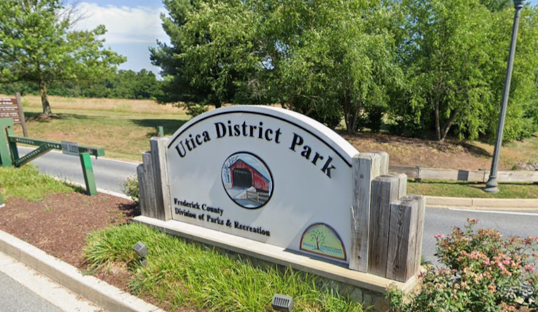
Frederick County officials broke ground Wednesday on a trail expansion at the northern end of Utica District Park, a project designed to provide cyclists and pedestrians with a safer, off-street route between the park and the historic Utica Mills Covered Bridge. The new segment, expected to take about 90 days to complete, will connect the six miles of trail already inside the park to Utica Road, surrounded by open farmland on the park's northern edge.
The project, dubbed the Utica Connection Trail, was detailed by Frederick County Executive Jessica Fitzwater in her September newsletter following the groundbreaking ceremony, according to Emmitsburg.net. As reported by DC News Now, Fitzwater said the project is part of Frederick County's broader commitment to promote green spaces for residents and visitors. The new trail will create another access point for the park while providing pedestrians and cyclists a way to reach nearby historic covered bridges.
A Long-Awaited Link to Utica Road
Once finished, the extension will stretch to Utica Road, also known as Utica Bridge Road, giving visitors a dedicated, off-street path instead of relying on the narrow rural roadway itself. That distinction matters: stopping and parking are strictly prohibited directly on Utica Road next to the covered bridge, per the same account, which notes that nearby rural roads lack shoulders or designated visitor parking near the narrow span. Public parking at Utica District Park has effectively become the key access point for anyone hoping to explore the area on foot or by bike.
The trail expansion will make walking and biking at the park safer and more enjoyable, per DC News Now's report, which also notes that the project falls under Frederick County, Maryland's local government purview. At 257 acres, Utica District Park is the largest district park in the county, offering views of the Catoctin Mountains alongside its athletic fields and picnic areas.
Decades of Investment at Utica District Park
This is not the park's first major upgrade. In September 2021, the county completed a $2.5 million Phase II development that added a 2,250-foot loop road, 48 ADA-accessible parking spaces, picnic pavilions, restrooms, and synthetic turf fields, according to the county's engineering partner on the project. Before the new Utica Road connection, the park's internal walking loop measured 6,040 feet, or roughly 1.1 miles, and operated alongside playground zones and a bike repair workstation.
The park has also served as a civic gathering place beyond recreation. Utica District Park hosted Frederick County's 275th Anniversary Jubilee in June 2023, a countywide celebration spread across seven zones representing local agriculture, government, and outdoor recreation, complete with a 150-drone light show marking the county's founding.
Tying Into a Historic Covered Bridge Circuit
The bridge at the center of the new trail's appeal has its own layered history. The Utica Mills Covered Bridge was originally built around 1843 over the Monocacy River as a 250-foot two-span structure, but it was washed away in the 1889 Johnstown Flood. Local residents salvaged half the timbers and rebuilt the span over Fishing Creek on Utica Road in 1891, creating the 101-foot Burr Arch truss bridge that still stands today.
That bridge holds the distinction of being both the oldest and longest of Frederick County's three surviving historic covered bridges listed on the National Register of Historic Places, where it was added in 1978. Frederick County is home to three of Maryland's eight remaining historic covered bridges — Utica Mills, Loy's Station, and Roddy Road — all within about 15 minutes of each other in the northern part of the county, a cluster that has long drawn scenic driving and cycling tours.
The trail groundbreaking also fits into a much larger county planning framework. Frederick County's 2026 Green Infrastructure planning reports show the jurisdiction contains more than 24,000 acres of federal, state, and local parkland, guided by countywide goals under the Livable Frederick Master Plan to expand interconnected greenways and bikeways. Fitzwater has made expanding pedestrian and bicycle trail networks a multi-year priority as part of that broader sustainable growth push.
It remains unclear whether future capital plans will extend Utica District Park's trail network further to link up with Loy's Station and Roddy Road, the county's other two historic covered bridges, to form a unified regional trail loop. For now, the 90-day construction window points to a swift buildout, with the finished trail set to give both local parkgoers and heritage tourists a safer path into one of northern Frederick County's oldest landmarks.



