

























































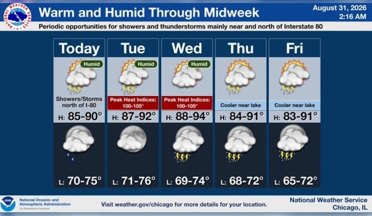
Chicago is starting Monday with mostly clear skies and temperatures around 75 degrees, but the easy-looking morning comes with a chance of showers and thunderstorms before the day settles down. The bigger shift arrives later: a hotter, more humid stretch builds through Wednesday, with the week’s peak heat expected midweek.
Storm Chances Ease After A Messy Start
Scattered showers and thunderstorms may linger through daybreak Monday, then fade as the morning goes on. Most areas should get a dry window around midday, although a stray afternoon shower or storm remains possible, with a high near 87 degrees and southwest winds of 10 to 15 mph gusting up to 25 mph, according to the National Weather Service Chicago/Romeoville.
Monday night stays warm, with a low around 75 and only a slight chance of storms before 10 p.m. No watches, warnings or advisories are listed for the Chicago forecast area, but a little flexibility is still wise for outdoor plans and evening commutes.
Heat Peaks Wednesday
Tuesday repeats the 87-degree high with mostly sunny skies and a 20% chance of a shower or thunderstorm between late morning and early afternoon. Wednesday looks like the hottest day, reaching about 89 degrees under sunny skies, while heat-index values could climb into the mid-to-upper 90s.
Storm chances return late Wednesday night and into Thursday morning, when the high should ease to around 84 degrees. The rest of the outlook trends somewhat cooler but not exactly fall-like: highs near 84 Friday, 82 Saturday and 81 Sunday, with periodic low-probability shower and thunderstorm chances.
A Fresh Update For Chicago’s Week
The latest forecast sharpens the week’s two-part story—spotty storms first, then a hotter stretch—following Hoodline’s Sunday outlook. For Monday, the practical takeaway is simple: keep rain gear handy early, then plan for heat and humidity to take over the rest of the week.





