

























































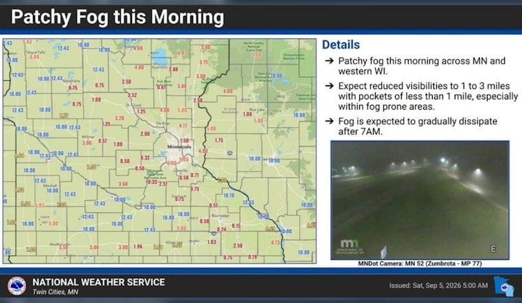
Minneapolis is starting Saturday with patchy fog and muggy air near 68 degrees, but the haze is on borrowed time. Fog should thin by 9 a.m., setting up a partly sunny afternoon near 85 with light east-northeast winds.
Saturday Offers The Best Outdoor Window
The National Weather Service Twin Cities/Chanhassen expects Saturday afternoon to bring the weekend's best outdoor window, with rain chances near zero and clouds breaking up. Saturday night stays partly cloudy, though a 20% chance of showers or thunderstorms arrives after 2 a.m.; rainfall, if it occurs, should be light.
Storm Chances Build Sunday And Labor Day
Sunday will be cooler at about 81 degrees, mostly cloudy, with a 40% chance of showers and thunderstorms. Labor Day also tops out near 81, but the chance of rain or storms rises to 50% as south-southeast winds increase to 10 to 15 mph. Outdoor plans may survive, but they will need a backup location and quick access to shelter.
Monday Night Into Tuesday Looks Most Unsettled
Rain and thunderstorms become more likely Monday evening and overnight, when the forecast calls for an 80% chance of precipitation and south-southeast gusts up to 30 mph. Tuesday brings another 80% chance of showers and thunderstorms, especially before 1 p.m., with a high near 85 and gusts again reaching 30 mph.
The timing is a notable update from Hoodline's earlier forecast, which described the holiday weekend as warm and unsettled but gave less emphasis to the wetter Monday-night and Tuesday stretch. No watches, warnings or advisories are listed for Minnesota or Wisconsin, but anyone hearing thunder should head indoors rather than wait out the storm.
A Cooler Reset Arrives Wednesday
Storm chances drop sharply Tuesday night, then Wednesday turns mostly sunny with a high near 79 and west-northwest winds of 10 to 15 mph, with gusts up to 30 mph. Thursday looks sunny near 80, while Friday warms back to about 83 with only a slight chance of morning rain showers.





