

























































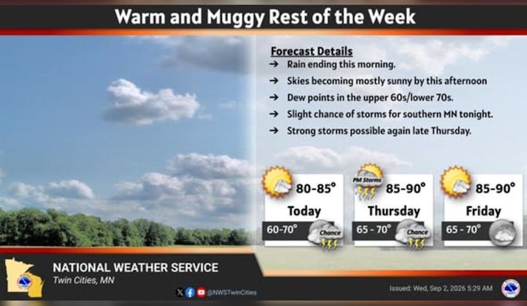
Minneapolis starts Wednesday with clear skies and temperatures near 67 degrees, but the brief calm will not last. A few early showers may linger before 8 a.m., followed by mostly sunny skies and a high near 84 as the city heads toward a hotter, stormier Thursday night.
Sunshine Takes Over After Early Showers
Rain chances are around 30% Wednesday morning, with any new rainfall expected to stay light. By afternoon, skies should turn mostly sunny, with east winds of 0 to 5 mph and temperatures reaching the mid-80s, according to the National Weather Service Twin Cities.
Wednesday night will be partly cloudy, with a low around 68 and a slight chance of showers or thunderstorms late. There are currently no watches, warnings or advisories posted for Minnesota or Wisconsin.
Thursday Night Brings The Bigger Storm Concern
Thursday will feel hotter and stickier, with a high near 87 and southeast winds of 5 to 10 mph. Showers and thunderstorms are possible early, but the more notable storm threat is expected Thursday evening and overnight.
Forecasters say storms could initially bring large hail, damaging winds and an isolated tornado threat before organizing into a line where damaging winds become the main concern. The update sharpens the storm risk flagged in Hoodline's earlier forecast, so outdoor plans should include a way to get inside quickly if storms develop.
Labor Day Weekend Stays Hot And Unsettled
Friday looks mostly sunny after a chance of morning showers and thunderstorms, with a high near 89. Saturday should reach 88 under mostly sunny skies, but storm chances rise Saturday night, while Sunday brings another chance of showers and thunderstorms with a high near 85.
Labor Day will be cooler but still fairly warm, with a high near 79 and a 30% chance of showers and thunderstorms. In other words, summer is still hanging around, but the forecast is asking holiday-weekend planners to keep an eye on the sky.




