

























































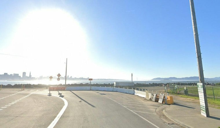
Crews have started installing temporary flood barriers on San Francisco's waterfront, racing to get the defenses in place before winter storms and a potentially historic El Niño push bay water over the seawall. Installation began Friday, Nov. 13, along the Embarcadero, with work scheduled during evening hours to limit disruptions to the busy corridor.
The effort is being led by the Port of San Francisco, which according to KRON4 has begun installing temporary flood barriers at several waterfront locations to prepare for potential El Niño-driven flooding during the 2026–27 winter season. Additional barriers are planned for Pier 45, Pier 80 along Islais Creek, and the south side of Pier 96, the station reports. Installation is expected to wrap up around Nov. 21, with the barriers remaining in place through April 2027, per the same outlet's reporting.
The system combines fixed and movable sections designed to retain up to 1.5 feet of bay water above the existing seawall and cut down on wave action during high-water events, the station's report notes. Movable sections will be deployed as needed to close off access points ahead of expected flooding and then pulled back once the danger passes. Even so, the Port is not promising a dry waterfront: some wave overtopping and water seepage are expected, and crews will monitor the system and make adjustments as needed, according to the report.
Why the Rush Along the Embarcadero
The urgency traces back to Oct. 25, when high tides flooded the Embarcadero even under calm skies, cutting off parts of Pier 14 and forcing the closure of sections of the sidewalk and bike lane, according to Axios. That outlet also reports the Port is planning barriers at four waterfront locations to reduce flood risk while preserving public access. Separately, ABC7 News describes the barriers as a combination of fixed and movable sections about 4 feet high.
Port tenants should expect some friction in the meantime. Businesses and operators along the waterfront may see temporary access changes or other disruptions during installation, deployment, inspection, maintenance and removal of the barriers, KRON4 reports.
A Record-Setting Ocean Signal
The numbers behind the scramble are striking. San Francisco's average sea level reached 12.4 inches above NOAA predictions in October, the largest monthly difference on record, according to Axios. El Niño-driven Kelvin waves are capable of raising coastal sea levels by another 6 to 12 inches, per NOAA as cited by the outlet, and federal forecasters put the odds of a record-breaking El Niño developing through year's end at 83%, the same report states.
That combination threatens to bring heavy rain, coastal flooding and powerful storms to the region this winter, Axios reports. The last time the Bay Area faced anything comparable, multiple atmospheric rivers caused widespread flooding and damage across the region during the winter of 2022–23, according to the outlet's reporting. City departments have already begun outlining how they plan to mitigate and respond to possible historic flooding and rainfall tied to the anticipated Super El Niño pattern, per Local News Matters.
Barriers Are a Stopgap, Not a Fix
Officials are clear that the current installation is temporary. The San Francisco Bay Conservation and Development Commission states that the temporary flood barriers must come down by April 30, 2027. A far larger undertaking is already in motion behind the scenes: the Port of San Francisco and the U.S. Army Corps of Engineers have developed a waterfront flood protection plan expected to take roughly three decades to implement, according to Axios.
Construction on the Downtown Coastal Resilience Project, part of that long-term plan, is expected to begin in 2029, Port spokesperson Eric Young told Axios. Until then, the temporary barriers now going up along the Embarcadero are meant to buy the waterfront some protection through a winter that forecasters increasingly expect to test it.



