Residents of Chicago and parts of northwest Indiana can expect a mix of weather conditions over the next several days, stretching into early next week. According to the National Weather Service, the area will see mostly sunny skies today with a high near 61 degrees, while gusty winds from the northwest may reach up to 25 mph.
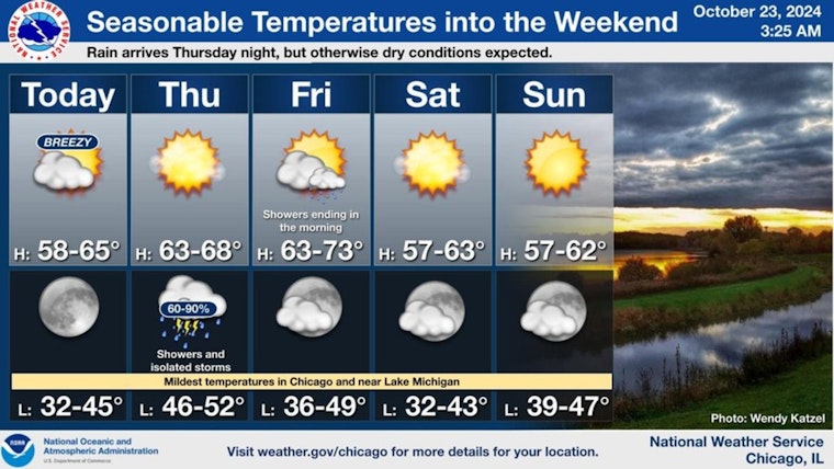
Breezy and cooler conditions will occur today. Showers and even a few storms arrive Thur. night, with dry conditions expected through the balance of Fri. through the upcoming weekend. Expect seasonable temps with cool, crisp nights and highs near 60 degrees this weekend. pic.twitter.com/hNKvlRaMYR
— NWS Chicago (@NWSChicago) October 23, 2024
The clear conditions are expected to persist into the evening, with temperatures dropping to a low of around 42 degrees. The calm however, is set to take a turn as Thursday night will bring showers, and possibly a thunderstorm between 1 am and 4 am followed by more showers after 4 am. This activity heralds a cold front, pushing the low to around 51 degrees, as indicated by The National Weather Service Chicago/Romeoville, which also forecasts an 80% chance of precipitation.
While Friday may start with a chance of showers and thunderstorms it will gradually clear up with a high near 65 degrees. "Breezy and cooler conditions will occur today. Showers and even a few storms arrive Thur. night, with dry conditions expected through the balance of Fri. through the upcoming weekend," according to a post from the NWS Chicago. The weekend forecast anticipates seasonable temperatures, cool crisp nights, and highs near 60 degrees.


