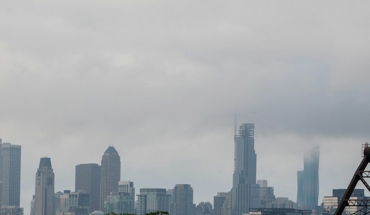
Residents of Chicago experienced reduced visibility Thursday morning due to dense fog enveloping the area, causing the National Weather Service to issue an advisory that warned of "sharply reduced visibility" with some regions seeing a quarter-mile view or less. This advisory impacted several Illinois counties including Lake, McHenry, DeKalb, Kane, DuPage, LaSalle, Kendall, and Kenosha County in Wisconsin, a situation detailed by the National Weather Service.
According to an NBC Chicago report, the fog was anticipated to linger near the Illinois-Wisconsin state line into the evening, and due to these conditions, the National Weather Service recommended that motorists slow down and make use of low-beam headlights to manage the hazardous driving conditions.
The weather forecast promises a wet continuation of the week with the likelihood of drizzle today and a 90% chance for rain on Friday, as per the weather forecast service. Subsequently, the weekend is set to see a decent possibility for more showers, with these patterns stretching into the early days of the next week and potentially culminating in a wintry mix of rain and snow by Tuesday night.
Meteorologist Kevin Jeanes from NBC Chicago Storm Team indicated the temperatures are experiencing a mild trend, stating, "It's the warmest its been in 10 days," acknowledging Thursday's indicators of a warmer end to both December and the year 2024. However, the reprieve is temporary as a "going to be getting colder" shift is forecasted with temperatures expected to dip into the 30s and 20s by late next week.
As the nights gradually recede post-Winter Solstice, Jeanes added, "We're gaining daylight," signifying a slow stretch in daylight hours by approximately 20 seconds more compared to the day prior, a bit of hopeful news in the thick of fog and drizzle, according to NBC Chicago's reporting.


