Chicago residents faced a drastic temperature drop this weekend, as the city's brief encounter with milder weather gave way to an arctic cold front that swept through the region. Friday's highs, according to FOX 32 Chicago report, temperature have soared up to the upper 40s. FOX 32 Chicago reported a chance of rain, shifting into a wintry mix or snow by early Saturday, particularly along and southeast of I-55.
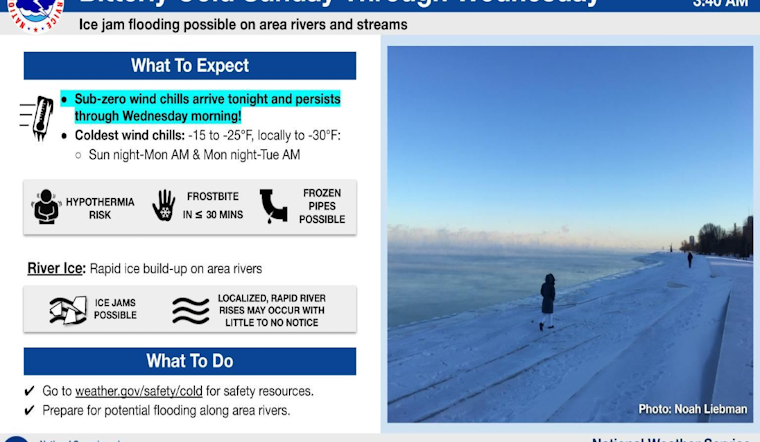
The weekend forecast signaled a sharp contrast with gusty north-northwest winds ushering in daytime temperatures relegated to the 20s on Saturday, and a further decline into the single digits on Sunday, reported by FOX 32 Chicago. Not only did temperatures take a nosedive, but accompanying wind chills made the cold snap feel significantly harsher, with readings as low as -5 to -15 degrees. In parts of northwest Indiana, residents also braced for the potential of lake effect snow, adding another layer to the wintry conditions, according to the National Weather Service.
The cold conditions were not expected to ease up quickly, with Sunday night forecasts predicting lows reaching -2 degrees, and wind chills potentially plummeting to a brutal -20 degrees. Frostbite concerns were raised by both sources, with FOX 32 Chicago warning that exposure of skin in these temperatures could lead to frostbite in as little as 30 minutes. The city prepared for the frigid start to the week, where subzero lows and single digit highs remained the norm through at least Tuesday.
Midweek forecasts suggest a gradual warming trend, with Wednesday highs moving into the mid 20s and Thursday seeing a near-30-degree uptick.


