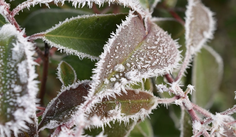
Brace yourselves, Indianapolitans, for a bout of chilly air and frost that could have you fretting for your spring blossoms. The National Weather Service in Indianapolis has issued a frost advisory in effect from the early bird hours of 3 AM to 9 AM EDT this upcoming Wednesday. Temps dipping down to a frigid 29 degrees are expected to grace parts of central, east central, north central, southwest, and west central Indiana. The NWS' Frost Advisory warns "Frost could harm sensitive outdoor vegetation."
Sensitive plants could be at risk, so it might be the right time to provide them some cover or bring them indoors for a night. With the advisory maintaining its status, those living in areas including Carroll, Warren, and Tippecanoe are advised to take necessary precautions. Keep in mind, "Sensitive outdoor plants may be killed if left uncovered," as the NWS Frost Advisory categorically states.
As for the rest of the week, it appears we're in for a mixed bag of weather conditions. After the frost clears, Wednesday itself promises sunshine with highs nearing 60. But don’t pack away the coats just yet; the week progresses with a mix of clear skies and clouds, occasional showers, and a potential thunderstorm on the horizon for Friday night. Temperatures are set to see-saw, reaching up to near 79 on Friday before descending again.
Looking at the weekend, stormy conditions could make a rumble with showers and thunderstorms likely, pegged at an 80 percent chance on Saturday and dipping to 50 percent by Sunday night. If you're in for the weather details, you can't miss the wind forecast either, gusting as high as 34 mph on certain days. To stay updated on weather changes, keep your eyes on local forecasts and continue checking the NWS website for the latest.


