Updated: November 3, 2025 at 8:30am PDT
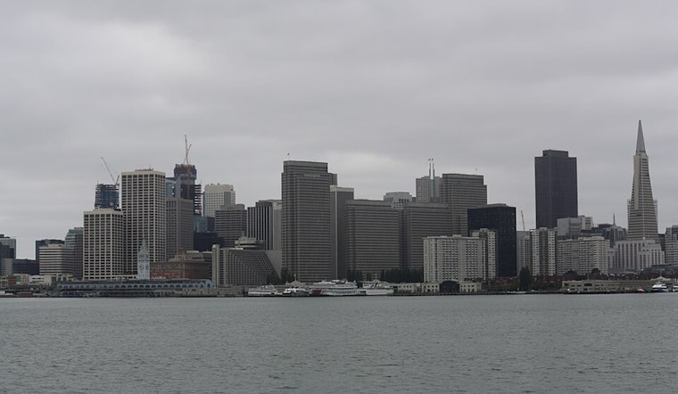
The Bay Area is bracing for what could be the strongest storm of the fall season, with meteorologists warning of potentially hazardous winds reaching 55 mph, thunderstorms, and widespread rainfall arriving Wednesday. San Francisco residents should prepare for a soggy and windy commute, especially during Wednesday morning's rush hour when the storm is expected to hit hardest.
According to an update from the National Weather Service, the substantial storm system will make landfall by mid-week, bringing potential travel disruptions and an increased chance of thunderstorms, especially across the North Bay and parts of the Central Coast. The greatest impacts are expected throughout the region on Wednesday, marking a significant shift from the mild conditions San Franciscans have enjoyed through the weekend.
Winds Pose Greatest Threat
While rainfall totals are expected to be moderate—about half an inch in San Francisco and Oakland, with up to 2.5 inches in higher terrain like Mount Tamalpais—the wind may prove to be this storm's most disruptive feature. Strong southerly winds could reach over 40 mph across much of the Bay Area, according to NWS San Francisco, with gusts potentially hitting 55 mph along the coast and 60 mph in elevations above 2,500 feet, as reported by SFGATE.
The timing couldn't be worse for Bay Area trees. "Many deciduous trees are still holding the leaves, which will make branches prone to snapping at lower wind speeds than they would be in midwinter," noted Yahoo News in its storm analysis. The combination of sustained winds and leaf-laden branches significantly increases the risk of downed trees and power lines, potentially causing difficulty driving, especially for high-profile vehicles.
Atmospheric River Drives the Storm
This week's weather system is being driven by an atmospheric river—a long plume of water vapor stretching from near Hawaii toward California. As reported by the San Francisco Chronicle, the parent storm, a broad low-pressure system over the Pacific Ocean, will be nearly 1,000 miles northwest of San Francisco, but its counterclockwise spin will guide the moisture-laden atmospheric river toward the West Coast.
While this atmospheric river won't last as long as the one that flooded parts of Northern California last November, it'll pack a punch in a short time. Rain began Monday afternoon near Eureka as the atmospheric river made landfall, with Del Norte, Humboldt, and Mendocino counties expected to pick up 2 to 5 inches of rain through Wednesday.
North Bay Faces Heightened Concerns
The North Bay will likely see the most significant impacts from this storm. According to NWS San Francisco, there's up to a 55% probability of receiving more than one inch of rain over a 72-hour period ending Thursday morning, with the greatest probability focused on the North Bay and Santa Cruz Mountains.
Roger Gass, a meteorologist at the National Weather Service's Bay Area office, specifically identified the 30-mile-long Mark West Creek in Sonoma County as one of the most well-known streams prone to flooding and roadway ponding during heavy rains. "That's where you're most likely going to see the greatest concern, and less so south of San Francisco," Gass told SFGATE.
While major river flooding isn't expected—the region is coming out of the dry season and waterways have plenty of capacity—nuisance flooding of North Bay creeks and streams remains a concern. Commuters should prepare to drive carefully, particularly Tuesday night into Wednesday, when minor flooding could occur and wind gusts could lead to fallen trees and power outages.
Thunderstorms Add Another Layer of Risk
Perhaps most unusually for this time of year, thunderstorm potential is on the rise come Wednesday morning along the surface front. According to NWS San Francisco, there's a 10-20% chance for storms on Wednesday, with the North Bay and parts of the Central Coast at greatest risk. The main hazards will be isolated lightning, pockets of moderate to heavier rainfall, and erratic, gusty outflow winds.
"An isolated thunderstorm or two is also possible over the North Bay," Gass said, as reported by the Mercury News. "We can't rule out thunder and lightning in the East Bay, either."
Beach Hazards Persist Through Tuesday
Before the main storm arrives, coastal residents and visitors should exercise extreme caution. A Beach Hazards Statement remains in effect for all Pacific Coast beaches through early Tuesday, warning of sneaker waves and strong rip currents. According to NWS San Francisco, these dangerous ocean conditions are being driven by the same storm system looming over the Eastern Pacific that will bring the mid-week rain.
Mariners face particularly hazardous conditions, with near-gale force southerly winds expected Tuesday night into Wednesday, accompanied by rain and possible thunderstorms.
November Marks Official Start of Rainy Season
This storm arrives right on schedule. "November is really the first month of our rainy season," Gass told the Mercury News. "So this one is not too unusual." The storm descending from the Gulf of Alaska is expected to kick off what meteorologists anticipate will be a "rather wet" first part of the month.
The timing is notably different from the surprise storms that pummeled the region at the start of October, which brought a month's worth of rain in a single day. That October storm—which dropped 1.5 inches in San Jose (the third-highest total for any October day since 1897) and over 2 inches in parts of the Santa Cruz Mountains—was far more unusual for its timing. It also likely ended fire season in Northern California, according to climate scientists.
The National Weather Service's 30-day outlook shows above-normal temperatures and precipitation are on the docket for November, suggesting this week's storm may be just the first of several systems to impact the region.
What to Expect Wednesday
Wednesday is forecast to be the stormiest day of the week, with a cold front moving through the Bay Area in the morning bringing widespread rain and blustery winds. About a half-inch of rain is forecast in San Francisco and Oakland, with less in the South Bay and more in the North Bay, according to Yahoo News.
Those southerly winds will blow relatively warm subtropical air into the Bay Area, keeping temperatures in the 60s Wednesday—only a few degrees below normal despite the overcast skies. The rain should be done sometime Wednesday night or early Thursday morning, with clear skies and upper 60-degree temperatures to follow before cloud-filled sunny days return for the weekend.
Preparing for the Storm
Residents should take this weekend to prepare. The brief period of mild weather before Tuesday night's arrival provides an opportunity to clean out gutters, secure loose outdoor items, and properly store items sensitive to rain and wind. Those with high-profile vehicles should consider alternative routes or delaying travel during Wednesday's worst conditions.
With thousands of Bay Area residents potentially facing power outages from downed trees and power lines—a common occurrence during wind events of this magnitude—it's wise to have flashlights, batteries, and backup power for essential devices ready. Recent storms have left tens of thousands without power across the region, sometimes for days in areas where multiple trees blocked access for repair crews.
For those keeping score, this will likely be the windiest system so far this fall in the Bay Area. While the rainfall totals won't approach the levels that cause major flooding, the combination of wind, rain, and thunderstorms makes this a storm system worth taking seriously.
Conditions are expected to clear up late Wednesday night into Thursday morning, with cooler temperatures lingering through Friday before a warming trend returns for the weekend.


_(02).jpg)