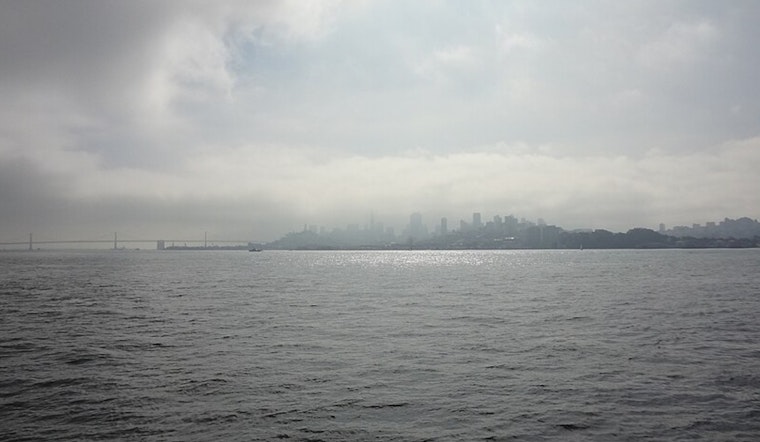
Another foggy Sunday morning greeted the Bay Area, with dense conditions shrouding inland valleys. However, meteorologists say this may be the last chapter in a stubborn weather pattern that has dominated the region for weeks, as beneficial rain finally arrives this week.
The National Weather Service issued a Dense Fog Advisory for the North Bay valleys and East Bay interior valleys until 11 AM Sunday. According to The Mercury News, visibility dropped to one-quarter mile or less across affected areas, creating hazardous driving conditions for early risers.
What makes Sunday's fog particularly noteworthy is not just its density, but what it represents: the tail end of a relentless pattern. The region is now positioned on the backside of a 500-millibar ridge that has controlled weather for the past couple of weeks, with a shortwave trough further weakening the longwave ridging that trapped fog and dry air over Northern California.
A Complex Fog Situation
Meteorologists report that both coastal stratus and inland valley fog are currently affecting the region—a combination that emerged after Saturday's strong southerly surge of stratus failed to mix out the radiation fog lingering in the valleys. While boundary layer winds have shifted from easterly to southerly over the past 24 hours, they remain weak at the surface, allowing the dense fog to persist through late morning.
Afternoon temperatures Sunday are expected to be cooler than they have been, thanks to more cloud coverage and dropping temperatures at the 850-millibar level. Both the longwave ridge and shortwave trough will continue sliding east through the day, but forecasters warn there's another good chance for fog impacts Sunday night as the lower atmosphere remains poorly mixed.
Finally: Rain Returns This Week
The real story developing for the Bay Area isn't the fog—it's what comes after. Meteorologists say zonal flow with a tighter pressure gradient will move in by Tuesday and persist through the week, supporting several rounds of light rain as higher moisture aligns with the new pattern.
According to the National Weather Service, high clouds on Monday will herald the approaching rain, with the first round expected to occur from Tuesday through Wednesday. Current forecasts show around a quarter inch in the North Bay and less than a tenth of an inch elsewhere—not a deluge, but beneficial precipitation nonetheless.
After drier air moves in Thursday, likely bringing a break, the next round of rain will arrive Friday and persist through the weekend. Without a deep trough in place, there's no real threat of heavy rain this week—the pattern favors lighter, steadier precipitation rather than intense storms.
Looking Ahead: Atmospheric River Potential
Beyond next weekend, forecasters are watching a potentially significant pattern shift. Ensemble cluster analysis reveals strong agreement in the overall pattern evolving to feature deep troughing just off the coast, which could support an atmospheric river early next week if moisture plumes align correctly.
The Climate Prediction Center continues to show a moderate risk for both strong winds and heavy rain from December 20-26. According to KRON4, an atmospheric river is forecast to bring warmer, wetter weather to the Bay Area during the holiday season, with the weather pattern that's causing heavy rain in the Pacific Northwest expected to expand southward into Northern and Central California.
Long-range ensembles show about a 25 percent chance of the region receiving three or more inches of rain between now and December 26. While December is typically San Francisco's wettest month with normal monthly rainfall of 4.76 inches, the region hasn't seen any rain since November 20—making the upcoming sequence particularly welcome as it chips away at this deficit.
Marine and Aviation Impacts
For mariners, a gentle to moderate breeze continues across coastal waters Sunday, with winds expected to increase to moderate to fresh across southern coastal waters Monday as the first weak system reaches the area. A Small Craft Advisory has been issued from 3 PM to 9 PM Monday for the area from Point Pinos to Point Piedras Blancas. Low seas persist through the remainder of the weekend before building to moderate to rough by midweek.
Aviation continues to be impacted by the fog and stratus, with conditions ranging from LIFR (Low Instrument Flight Rules) to IFR to MVFR filling in across the forecast area. Clearing will be slow Sunday, with mix-out times expected in late morning to early afternoon. Fog and stratus are forecast to redevelop tonight and Monday morning, affecting SFO and other Bay Area terminals.
The End of a Dry Spell
Sunday's fog marks a transition point for the Bay Area—the last gasp of a high-pressure pattern that has brought weeks of dry weather, cold valleys, and persistent low clouds. As reported yesterday by Hoodline, this extended dry spell has lasted about three weeks since the last significant rainfall on November 20.
While drivers navigating Sunday's fog should continue to use low-beam headlights, slow down, and leave plenty of distance between vehicles, they can take comfort knowing this may be one of the last fog advisories for a while. As rain moves in this week, it should finally disrupt the relentless pattern that has allowed tule fog to dominate valley conditions.
For those who've grown weary of the gray, chilly mornings, the forecast offers a double promise: beneficial rain to break the dry spell, and the potential for more significant precipitation around the holidays. It's a welcome shift for a region that's been locked in an unseasonably stable—and stubbornly foggy—pattern for far too long.


_(2).jpg)