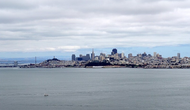
After a week of sunny skies and mild weather, the Bay Area woke up Sunday to another gorgeous day, but forecasters say this dry stretch won't last much longer. High clouds are painting colorful sunrises and sunsets while temperatures gradually cool down, and there's growing confidence that rain could return before January ends.
It's been quite a turnaround from the start of the month. The region got hammered by back-to-back atmospheric river storms around New Year's, with record-breaking king tides and flooding across Marin, Sonoma, and coastal areas. Roads were underwater, campgrounds were evacuated, and the Bay Area picked up 1.5 to 2 inches of rain—with mountain areas seeing 3 to 4 inches—through early January. But since those storms cleared out around January 8th, a dome of high pressure has settled in and basically shut off the rain faucet.
According to the National Weather Service, that high-pressure system peaked last Wednesday at near-record strength but is now slowly weakening. By Friday, atmospheric conditions should return to normal for this time of year. What that means for regular folks: after about a week of unusually warm afternoons and chilly mornings, temperatures are gradually settling back to typical January patterns.
How Warm Has It Really Been?
The weather pattern that's been keeping things pleasant isn't your typical January setup. Meteorologists call it a "ridge of high pressure"—essentially a dome of calm, sinking air that blocks storms and keeps skies clear. This particular ridge has been unusually strong and stubborn. As Hoodline reported earlier this week, both daytime highs and overnight lows have been running about 10 degrees warmer than normal for mid-January.
Sunday's forecast calls for a crisp morning with some patchy fog—particularly around Concord, which has been socked in for several hours—followed by a colorful sunrise thanks to those high clouds, warm afternoon with filtered sunshine, and another stunning sunset. "Enjoy the weather today, it doesn`t get much better this time of year," the National Weather Service wrote in its early morning discussion.
Why Some Areas See Fog While Others Stay Clear
Here's what's happening with the fog overnight: high clouds between 27,000 and 37,000 feet are acting like a blanket, trapping heat near the ground instead of letting it escape into space. That kept Saturday night's valley temperatures 1-5 degrees warmer than the night before. But even with that extra warmth, it hasn't been enough to stop thick Tule fog from forming in the Central Valley, where visibility has dropped dramatically from Sacramento to Hanford.
The weird temperature flips that created dramatic inversions earlier this week—where hilltops were a toasty 70°F while valleys shivered at 39°F—have calmed down considerably. Winds have weakened significantly, with Mount St. Helena now seeing gentle 5 mph gusts instead of the nearly 50 mph blasts from Friday night. That means less dramatic temperature differences between valleys and hills, though some fog is still forming in low-lying spots, as per SFGATE.
When Will the Rain Return?
The weather pattern is starting to shift. A weather system spinning off the Pacific coast will send a weak storm toward California late this week, though it looks like most of it will stay offshore. Don't expect much rain from this one—maybe a few sprinkles at best—but it's important because it'll help break down that stubborn high-pressure dome. According to the National Weather Service, this system will act as "a catalyst to usher in a more active pattern the following week, which could bring us some long-awaited rain for the last few days of the month."
The timing couldn't be better. The early January storms filled North Bay reservoirs like Lake Sonoma and Lake Mendocino, with managers actually having to release water to make room for potential future storms. California's water picture looks excellent right now—the state eliminated drought conditions for the first time in 25 years, with seven of 12 major reservoirs sitting at 75% capacity or higher. So this dry week is more like a welcome breather than a cause for concern.
Good News for Travelers
If you're flying out of the Bay Area Sunday, conditions look great. Forecasters expect clear skies at most airports with light, variable winds—the kind of conditions pilots love. The main exceptions are some North Bay and East Bay airports that might see patches of fog through sunrise, but even that should clear quickly. San Francisco International should see light northeast winds in the morning that'll shift to northwest by afternoon as temperatures warm up.
For boaters, gentle northeast to east breezes will blow across San Pablo Bay, the Delta, and through the Golden Gate through early next week. Ocean conditions are calm now with low seas, though a northwest swell will gradually build to 5 to 6 feet by the middle of the week—nothing too dramatic but worth noting if you're planning to head out.
The Bottom Line
That high pressure system that's been keeping Bay Area weather calm and pleasant is finally starting to lose its grip. While the immediate forecast still calls for sunny days with cool mornings and warm afternoons, the pieces are slowly falling into place for winter to make a comeback. The big question isn't whether the weather will change—it's when actual rain will show up at your doorstep.
For now, enjoy what forecasters are calling some of the best weather of the year. Sunny skies, mild temperatures, gentle winds—it's the kind of January day that reminds people why they live in the Bay Area. Just remember: this is California winter, and change is always just around the corner.


.jpg)