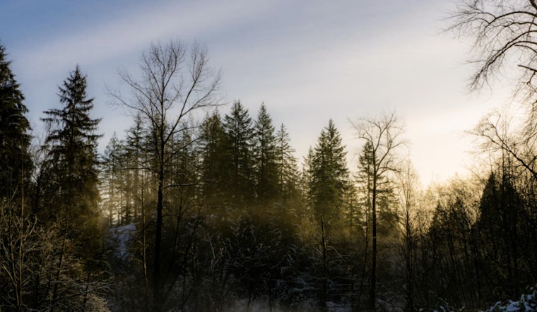
Portlanders woke up today to a chilly mix of low-lying fog and patchy frost that threatened to slow the morning rush. The payoff comes later, with skies expected to turn mostly sunny by midday and temperatures climbing to a milder high near 55°F.
Fog And Frost This Morning
Pockets of frost and dense fog are spreading across the Willamette Valley and sheltered river corridors through midmorning, with some spots slipping to near or below freezing. The Lane County lowlands are under a Dense Fog Advisory until noon, and the Portland airport carries a modest chance of brief low ceilings and reduced visibility before conditions ease.
Forecasters expect any fog and frost to burn off between about 10 a.m. and 12 p.m., according to the National Weather Service.
Afternoon Outlook
By midday, sunshine should take over and push highs to around 55°F, with temperatures slipping a few degrees later in the afternoon. North winds stay light at about 3 mph, and overnight lows are projected to fall back into the mid-30s.
Coastal Waters And Boaters
Conditions turn rougher over the outer coastal waters Friday and Saturday as a northwest swell lifts wave heights to roughly 9–10 feet. Gusts could reach around 25 knots (about 29 mph) over the outer waters. A Small Craft Advisory remains in effect for exposed waters into Saturday afternoon, so boaters are urged to skip offshore runs and stay on top of the latest marine updates.
Weekend Preview
A cut-off low sliding through northern California may toss some light rain into the region Saturday into Sunday, mainly from Salem southward. Areas north of Salem have lower odds of seeing measurable rain from this system.
Snow levels are expected to hover above roughly 6,000–7,000 feet, which should keep Cascade passes largely free of snow for this particular event. Drier, milder weather is expected to return early next week before another system moves in by midweek.
What To Know For Your Commute
If you are heading out Friday morning, give yourself extra time, stick with low beams in the fog, and watch closely for slick bridges and frost on metal surfaces. Visibility should improve for most neighborhoods by late morning, but it is still worth checking for any service alerts if your route runs through river corridors.
We published a similar forecast yesterday; see our fog-to-sun forecast for context. Because today’s Dense Fog Advisory and the Small Craft Advisory are new, this update reflects the latest guidance for Friday, Feb. 27, 2026.


