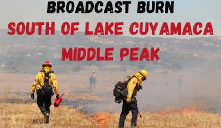
San Diego County residents could see a curtain of smoke over the mountains today, as fire crews carry out a prescribed burn on Middle Peak just south of Lake Cuyamaca. CAL FIRE and California State Parks say smoke from the operation will be visible across much of the county and may affect air quality in nearby communities, so park users and neighbors are being urged to anticipate hazy conditions during the burn window and plan accordingly.
According to CAL FIRE/San Diego County Fire, crews plan to ignite the burn in the Middle Peak area, just south of Lake Cuyamaca, and have warned that smoke will be visible throughout the county. CAL FIRE notes that prescribed burns are typically scheduled only during narrow weather windows, with on-site personnel and air resources staged and ready, per CAL FIRE.
In coordination with @CAStateParks Cuyamaca Rancho State Park, we will conduct a prescribed burn tomorrow, April 22nd, in the area of Middle Peak, just south of Lake Cuyamaca. Smoke will be visible from the immediate area and throughout the county. pic.twitter.com/do20MnHHgg
— CAL FIRE/San Diego County Fire (@CALFIRESANDIEGO) April 22, 2026
Where the Burn Will Happen
Middle Peak rises above Lake Cuyamaca inside Cuyamaca Rancho State Park, along Highway 79, about five miles north of I-8. For the latest on fire restrictions and current park conditions, visitors are directed to call (760) 767-4037 or the park office at (760) 765-3020, according to Cuyamaca Rancho State Park.
Smoke, Health and Travel
Smoke from prescribed burns can drift and affect people downwind. Those with asthma, chronic lung disease or heart conditions, along with older adults, children and pregnant people, are advised to limit outdoor activity while smoke is in the air. The California Department of Public Health provides guidance on getting ready for smoke, and the AirNow Fire & Smoke Map can help residents track local air quality and decide what precautions to take.
Why Crews Use Fire on Purpose
Land managers rely on prescribed fire to knock back hazardous fuels, support fire-adapted ecosystems and reduce the odds of large, destructive wildfires. CAL FIRE's fuels-reduction and vegetation management programs describe how controlled burns work alongside thinning, chipping and defensible-space projects as part of a broader strategy, per CAL FIRE.
During the operation, visitors should expect visible smoke near Highway 79 and around Lake Cuyamaca. If you are concerned about access or trail conditions, check the park's page for the latest updates. We will keep an eye on agency posts and update this story if the burn schedule changes or new safety notices are issued.


