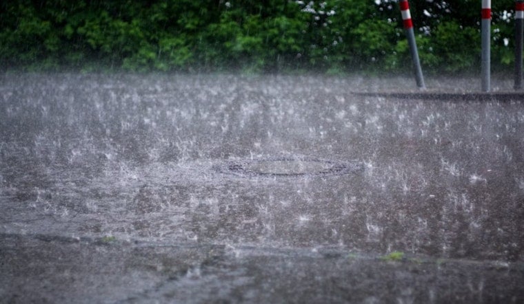
Clouds, muggy air near 70°F, and a whole lot of rain on deck greeted Indianapolis early Friday, June 26, 2026. Multiple rounds of showers and thunderstorms are expected through Saturday, with south-central parts of the metro sitting under a Flood Watch as repeated downpours threaten to dump a widespread 1 to 3 inches of rain and trigger pockets of flash and urban flooding. Brief, heavy bursts could sharply cut visibility, leave standing water in low spots, and slow both the morning and evening commutes.
What To Expect Friday
Showers and thunderstorms are possible before 8 a.m., then become more numerous and locally heavy through the afternoon and evening. Highs should top out in the low to mid 70s, around 74°F. Some cells may deliver torrential downpours and, across far southern counties, isolated severe storms with damaging wind gusts or a brief tornado cannot be ruled out. For the latest watches, warnings, and timing, check the National Weather Service in Indianapolis.
Flood Risk And Safety
With soils already saturated in parts of central Indiana, forecasters say a widespread 1 to 3 inches of rain is possible across the watch area, with locally higher totals where storms repeatedly track over the same spots. If you live in a low-lying neighborhood or store belongings in a basement, move valuables to higher ground ahead of the heaviest rain, and avoid walking or driving through flooded streets. Remember: turn around, do not drown. For background on how the watch expanded this week, revisit our earlier reporting.
Commute, Events And Travel
Plan on slower travel. Heavy rain will reduce visibility on the roads and could prompt short-term closures at low-lying intersections, and local transit may run more slowly than usual. Operations at Indianapolis International Airport could see delays and low ceilings this afternoon and tonight, so check with your airline before heading out. If you have to drive, ease off the gas and give yourself extra stopping distance around any standing water.
Looking Ahead
The front is expected to begin lifting north on Sunday, but the pattern flips quickly. A significant warm up is on the way next week, with highs climbing into the low to mid 90s and heat indices topping 100°F by Monday and Tuesday. As the storm threat eases and the heat builds, keep an eye on forecasts and heat safety guidance from the National Weather Service in Indianapolis.


