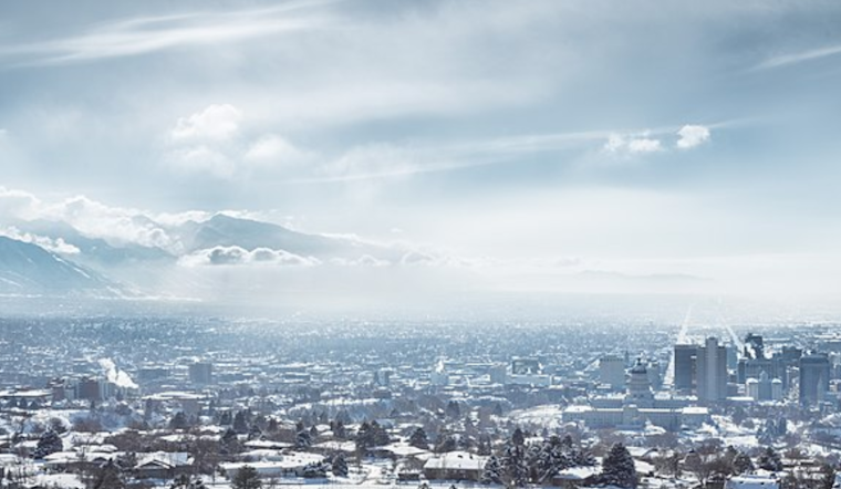
Residents of Salt Lake City woke up to a chilly morning as the National Weather Service reported an overcast sky with temperatures hovering around 28°F. As per their latest update, the humidity stands at a significant 79%, with winds coming from the North-Northwest at a gentle 5 MPH. Visibility remains clear at 10 miles despite the near-freezing dewpoint of 23°F.
The forecast, last updated at 7:05 AM MST, suggests a sunny day ahead with a calm breeze shifting from the north to northwest around 5 mph in the afternoon. The peak temperature is expected to reach a modest high of 35°F, according to the National Weather Service. The evening will likely continue the clear trend, with an anticipated low of around 19°F and light, variable wind conditions.
Moving into Friday, Salt Lake City will see increasing clouds with a high near 38°F and light winds from the east-southeast. The weather takes a turn on Friday night with a 60% chance of snow after 11 pm, with less than an inch of accumulation expected. This shift marks the beginning of a series of days with intermittent snow chances and mostly cloudy skies.
As the weekend approaches, the probability of snow escalates to 50% on Saturday, with new snow accumulation of 1 to 2 inches possible. The temperatures will remain consistent, with a high of around 35°F and winds from the West-Northwest. However, the likelihood of snowfall drops significantly come Saturday night, reducing to just 20% alongside mostly cloudy conditions, and a low of about 23°F.
Looking ahead to next week, the National Weather Service predicts a continuing pattern of 20% snow chance on Sunday and mostly cloudy skies throughout the early hours of the week. However, residents can expect some reprieve with partly sunny skies on Monday and a high once again nearing the mid-30s. The evenings will stay brisk with lows reaching into the mid-teens before a returning sun warms the city once more by midweek.


.jpg)