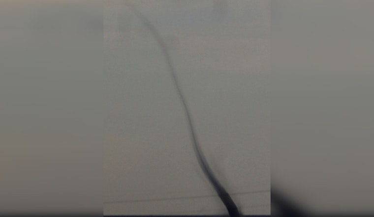
Residents of Randolph County witnessed an unusual meteorological event yesterday when a landspout tornado touched down in the open fields near the central Indiana town. As reported by FOX59, the National Weather Service (NWS) classified the phenomenon as a landspout with an EF-U rating, indicating that while it was tracked through open farmland, it is not believed to have caused any damage.
The NWS had issued a special weather statement for Randolph County around 6 p.m. yesterday, alerting the public to the possibility of a landspout; however, hail was not expected. This event recalls the memory of a deadly EF-3 tornado that had ripped through Winchester in March 2024. Despite the lesser severity of the recent landspout, it still prompted attention and caution from locals and experts alike.
As per a WISHTV report, the tornado was rated as "unknown" on the Enhanced Fujita scale due to its lack of damage. Witnessed by residents, images and videos of the landspout were circulated on social media, leading to the NWS's involvement. Kaleb Steveson of Muncie and Thomas Bigelow were among those who documented the phenomenon, capturing video and photographic evidence of the landspout near Farmland and Winchester, respectively.
Experts have clarified that while landspouts and tornadoes share similarities, there are distinct differences between the two. "Landspouts are surface-based circulations that extend into the clouds with nonsevere storms typically," said Storm Track 8 meteorologist Ryan Morse, in a statement obtained by WISHTV.
For those interested in the technical distinctions, further explanations are available via the Community dropdown menu at various radio station websites, courtesy of Region News Team Meteorologist Matt Wintz, as noted in Indiana105.


