

























































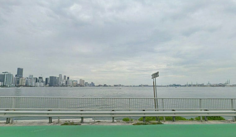
On September 18, 1926, a Category 4 hurricane with 145 mph sustained winds made landfall near Palmetto Bay, about 10 miles south of downtown Miami. The storm killed hundreds, helped bring down some of the city's most powerful developers and exposed weaknesses in warnings, construction standards and casualty accounting. A century later, researchers estimate that the same track would produce about $235 billion in damage if it crossed today's built-out South Florida coastline, making it the costliest storm on record.
The storm's warning system was a product of its era. Hurricane alerts in 1926 involved communication with U.S. Weather Bureau headquarters in Washington, D.C., and Miami's local office issued a generic northeast storm warning at noon on September 17, according to the National Weather Service. A full hurricane warning was issued at 11 p.m. that night, leaving sleeping residents fewer than six hours of notice before landfall. As WPLG Local 10 reports, the storm engulfed Miami shortly before daybreak, producing nearly 11 feet of whitewater and generating gusts of 128 mph.
A Deadly Trick of the Eye
The storm's 43-mile-wide eye produced a deceptive pause over Miami. Residents who interpreted the sudden calm as the end of the hurricane ventured outside, while vehicles carrying evacuees crowded the County Causeway toward the mainland. The back half of the storm arrived minutes later, and, according to the same account, most of the deaths occurred after that brief lull.
The National Weather Service adds a vivid detail to that same lull: Miami Weather Bureau meteorologist Richard Gray ran through Miami's streets shouting warnings. A Robinson anemometer installed atop the three-story Allison Hospital — located in what is now Mid-Beach — recorded 138 mph at 8:12 a.m. before it was blown away less than an hour later.
An Undercounted Death Toll
The American Red Cross reported nearly 400 official deaths from the storm, but that count excluded scores of Black farmworkers lost in the disaster, according to the same Local 10 report. The undercount extended well beyond the coast. Farther inland along Lake Okeechobee, storm surge breached muck dikes and flooded Moore Haven; reports cited up to 15 feet of flooding, 23 deaths in one collapsed house and about 250 deaths in Clewiston, according to the Journal of Policy History.
That catastrophe at Lake Okeechobee, along with a second hurricane there in 1928, pushed Congress to act. Lawmakers passed the Rivers and Harbors Act of 1930, authorizing federal construction of more than 83 miles of levees that eventually grew into today's 143-mile Herbert Hoover Dike surrounding the lake, according to the U.S. Army Corps of Engineers. The dike system wasn't completed until the late 1960s.
A Boom Turned to Bust
Back in Miami, the storm's aftermath reshaped the region's economy overnight. Land that sold for $60,000 in 1925 was available for $600 the following year, per the Local 10 report, and prominent developers George Merrick, Carl Fisher, and D.P. Davis were all left in financial and personal ruin. The hurricane caused around $100 million in damage, making it the costliest U.S. hurricane to date and the costliest American disaster since the 1906 San Francisco earthquake and fires, effectively pricking the national real estate bubble of the Roaring Twenties three years before the Wall Street crash.
The University of Miami, founded just months earlier, persevered through both the hurricane and the Great Depression that followed, as Hoodline has previously reported. Years later, the original Miami Orange Bowl stadium opened in 1935 as part of a civic promotion effort specifically intended to market and revitalize the city following the combined blows of the hurricane and the 1929 crash, Hoodline has also noted separately.
Building Codes Then and Now
Building standards in 1926 varied wildly by city. Coral Gables had implemented relatively strict building codes and suffered no deaths in the storm despite considerable damage, while Miami Beach and greater Miami had virtually nonexistent building codes, zoning, or inspection requirements at the time, per the Local 10 report. In response, Miami appointed John Farrey as its first chief building inspector, tasking him with developing and enforcing the city's first universal building code — a standard later adopted by more than 5,000 cities nationwide.
That regulatory arc continued for decades. Following postwar population growth, Dade County adopted the South Florida Building Code in 1957. Hurricane Andrew exposed failures in the region's building standards in 1992, according to the Miami-Dade State Attorney's Office. Hoodline has detailed how Andrew's 165 mph peak winds, as a Category 5 storm, ultimately led to the unified Florida Building Code in Andrew's lasting legacy, which replaced more than 400 separate local codes statewide in 2002 and established High Velocity Hurricane Zones exclusively for Miami-Dade and Broward counties, mandating impact-resistant glazing and reinforced roof-to-wall connectors. Those codes received a further major update in 2017.
Despite Andrew's ferocity, meteorologist Max Mayfield said Andrew was not the big one, per Local 10's account. Andrew struck about 10 miles farther south than the 1926 storm and spared downtown Miami and Miami Beach from its most catastrophic weather, even though the 1926 hurricane was about twice Andrew's size.
What a Repeat Would Cost Today
Researchers estimate a comparable modern storm would cause more than $200 billion in economic losses, according to Local 10's reporting, and a normalization estimate put comparable losses at about $235 billion in 2018. That would make the 1926 storm's track the costliest hurricane on record in the United States if it struck today, a reflection of just how much coastal population and property value has grown along South Florida's shoreline since 1926.
Florida began beach erosion control efforts in the 1960s and dune restoration in the 1970s; Miami Beach now maintains seven miles of shoreline dunes as part of its storm defenses. Local historians note that Miami has a history of recovering from major hurricanes, much as Galveston, Texas, rebuilt after its own golden era ended with the Great 1900 Galveston Hurricane, and as Indianola, Texas, never fully recovered after being decimated by hurricanes in 1875 and 1886.
What the Modern Coast Must Plan For
The scale of today's exposure is clear even without a like-for-like population series stretching back to 1926. According to Miami-Dade County's Local Mitigation Strategy, HAZUS estimated that the region had 575,844 buildings in 2019, with an aggregate total replacement value of $213,289,402. The figure provides a modern benchmark for the development and property base that a storm along the 1926 track could affect, but the report does not by itself establish the exact population or housing-value increase since 1926.
Modern preparedness also involves considering where water is expected to go alongside a storm's category. For neighborhoods along the historic path, that remains a planning consideration: evacuation and flood decisions must account for expected water impacts as well as wind strength.
A modern memorial marks where the story began: the National Weather Service and state officials dedicated an official State of Florida historical marker on September 18, 2007, at NE 1st Avenue and 1st Street in downtown Miami, marking the site of the old Federal Building where the Weather Bureau office once stood near where meteorologist Richard Gray ran into the streets a century ago.
This Week's Tropics Watch
The anniversary also comes with the Atlantic still under observation. Local 10 reported that forecasters had removed Invest 98L, a low-pressure system in the central Atlantic, from the tropical weather outlook after its development prospects faded. Invest 99L, southwest of the Azores, was organizing rapidly and could become a tropical depression or named storm by Friday; Fay was next on the season's naming list. The system was expected to move southwest over the open Atlantic, with no other development anticipated through at least early the following week.





